
“Icaros is your one stop shop for creating
accurate imagery products ready for analysis”
Jim Peters
VP Products and Services
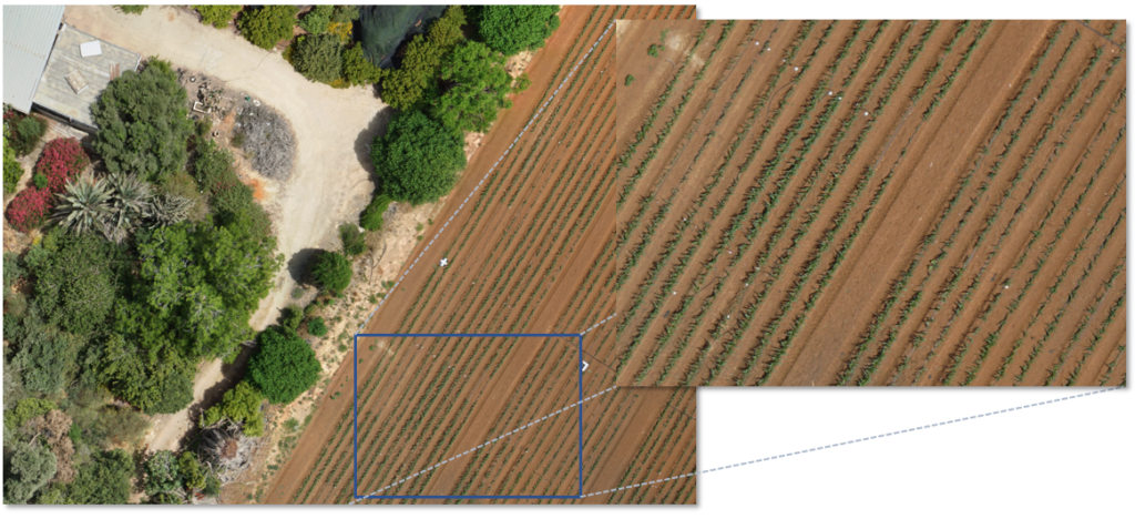
ORTHOMOSAIC - We produce GIS ready ortho mosaics using our OneButton™ software giving clients spatially accurate products. OneButton™ was developed with a robust algorithm for producing seamless orthomosaics. This is an example of a 2.0 cm pixel UAV project.
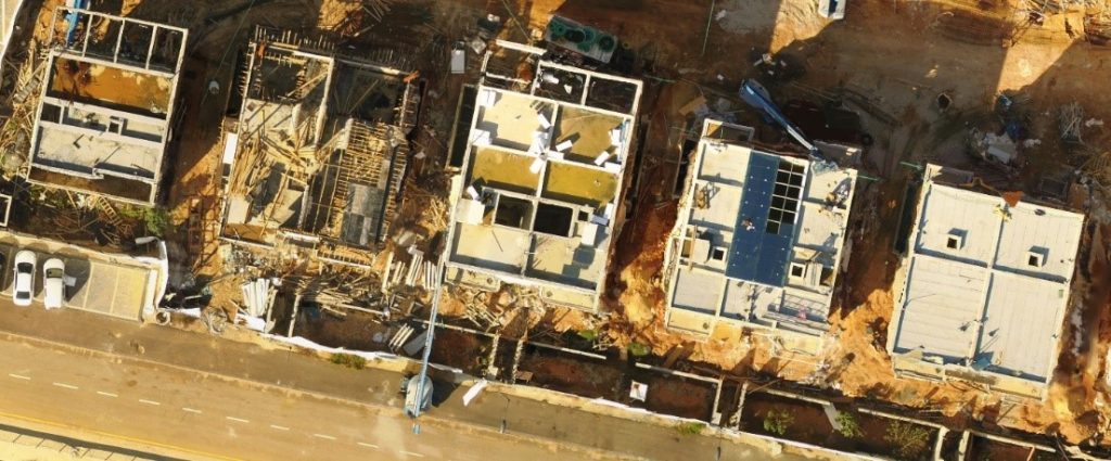
TRUE ORTHO - Automated true ortho mosaic imagery produced with our OneButton™ software provide clients very high accuracy products. True ortho provides you with the ability to see features on the roof and on the ground with no obstructions.

3D MESH - We specialize in the use of UAV acquired imagery to produce high accuracy 3D Mesh products for a variety of use cases.

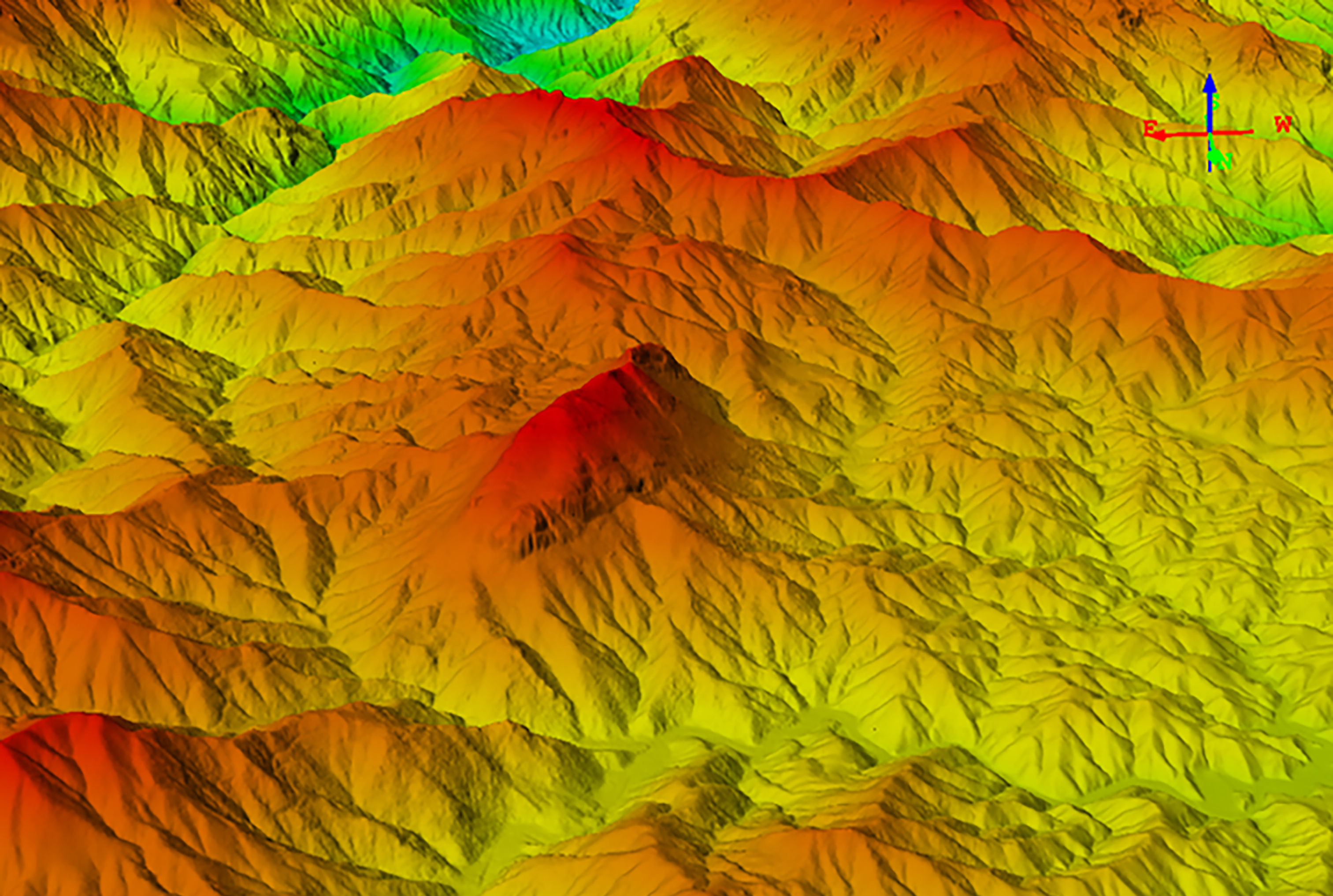
CONTOURS - OneButton™ software produces Digital Elevation Models (DEMs) and contour maps to visualize the terrain surface.

ORTHO DRAPED ON DENSE DSM - Combining these two mapping products provides useful visualization tools for analysis.
LIDAR - Icaros provides its clients with the option to integrate LiDAR into your delivery based on project analysis requirements of the terrain surface.
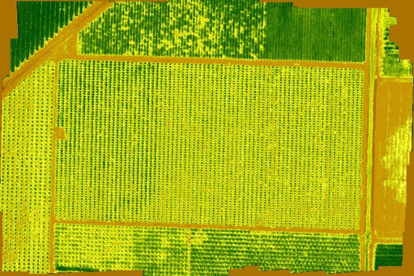
Multispectral - Agricultural indices are produced in OneButton using imagery acquired from multispectral UAV sensors (i.e., MicaSense, Tetracam and Agrowing). OneButton can maintain the original pixel values for highly accurate analysis of agricultural areas. Our customers are using multiple vegetation indices to detect anomalies in vegetation growth, plant disease and watering issues.
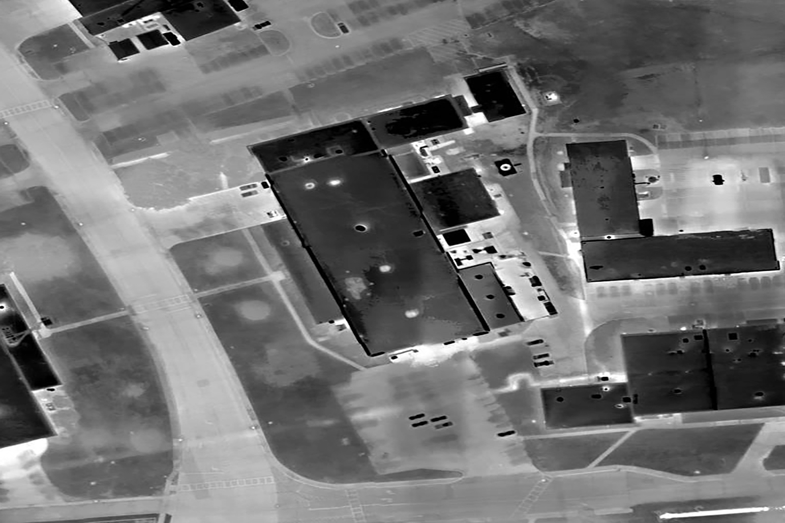
THERMAL MOSAICS - Icaros has over a decade of experience in providing thermal mosaic products to our global clients in a variety of industry standard formats.